Included in this update of a Journal of 9/11 Studies publication is information pertaining to aspects of Performance Based Navigation systems in place prior to September 11, 2001, that can allow for highly precise GPS-based auto-pilot guidance of the Boeing 757 and 767 aircraft allegedly overtaken by foreign hijack pilots that day. Included is a GPS guided auto-pilot alternative explanation for the 330 degree descending turn performed by American Airlines flight 77 prior to its reported impact with the Pentagon building.
Also included, are accounts by United Airlines flight training personnel contained in an unclassified 9/11 Commission record, who allege that the pilots accused of hijacking commercial aircraft on September 11, 2001 were not capable of operating aircraft systems as alleged.
http://www.journalof911studies.com/volume/2008/AutopilotSystemsMonaghan.pdf
Plausibility Of 9/11 Aircraft Attacks Generated By GPS-Guided Aircraft Autopilot SystemsAidan Monaghan (B.Sc., EET)
Abstract
The alleged flight performances of inexperienced pilots accused of controlling four complex aircraft during the terrorist attacks of September 11, 2001 has surprised observers. Moreover, official information presented to demonstrate terrorist pilot control of the said aircraft has been either unverifiable or demonstrated to contain noteworthy anomalies. The flight paths of the September 11, 2001 attack aircraft bear characteristics common to the capabilities provided by automated flight systems and related technology that emerged just prior to these attacks. The use of augmented GPS auto-pilot systems during the said aircraft attacks is hypothesized.
Introduction
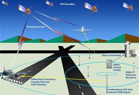
U.S. federal government and civil aviation industry publications describe the development and implementation pre-September 11, 2001, of state-of-the-art systems capable of facilitating precise automated navigation of the Boeing 757 and 767 aircraft used that day to a given destination. The Global Positioning System (GPS) is a space-based radio-navigation system that generates accurate positioning, navigation and timing information for civil use at no cost. The information signal can be obtained through the use of GPS signal receiving equipment.[1]
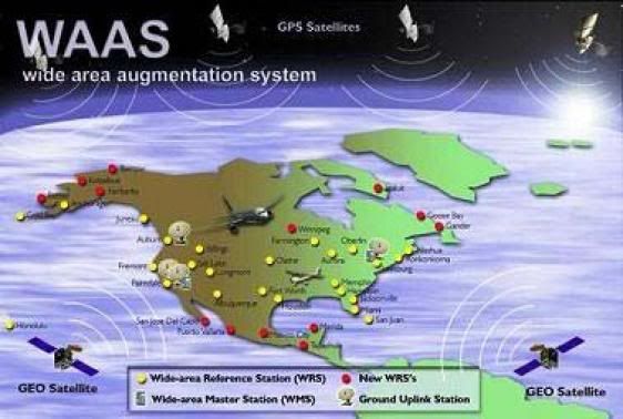
Augmented GPS signal service intended to replace dated and expensive ground-based aviation navigation signals, was developed during the mid-to-late 1990s by the Federal Aviation Administration (FAA) and Raytheon. Serving on Raytheon's Special Advisory Board was "Project for the New American Century" signatory Richard Armitage, although it is unknown precisely when he served in this capacity.[2] Known as the Wide Area Augmentation System (WAAS), precisely surveyed ground-based Wide-area Reference Stations monitor and collect GPS satellite signal errors. Ground-based Wide-area Master Stations then transmit corrected GPS signal information to ground-based Ground Uplink Stations, that then transmit the corrected GPS signal information to Geostationary Satellites. These satellites then broadcast the corrected positional information back to Earth for use within a GPS-like signal.[3]
The FAA announced on August 24, 2000 - just 13 months prior to the September 11, 2001 attacks - that the WAAS signal was available pending final approval by the FAA. Horizontal and vertical positional data accurate to between one to three meters and sufficient for Category I precision aircraft runway approaches, was now available throughout the contiguous United States.[4][5] Normal GPS service only provides placement accuracy to within 100 meters. Conventional en route aviation navigation beacon signals were only able to provide placement information accurate to within one mile.[6] Raytheon's director of satellite navigation systems even reported that rescue personnel utilized the newly activated WAAS signal, in order to precisely survey the Ground Zero site following the September 11, 2001 terrorist attacks.[7]
Performance Based Navigation
The activation of the WAAS signal contributed significantly to the accuracy of an aircraft navigation and landing procedure system developed during the 1990s known as "Required Navigation Performance" (RNP), which utilizes precisely constructed "highways in the sky" that can be navigated by the autopilot systems of aircraft like those involved in the terrorist attacks of September 11, 2001. WAAS enabled RNP technology "pinpoints the location of a fast-moving jet to within yards".[8] Such routes "never vary more than 18 meters - half the wingspan of a Boeing 737".[9] Upon the introduction of the WAAS signal utilized by the RNP system it was predicted that "a pilot will be able to determine the airplane's vertical and horizontal position within six or seven meters (about 20 to 23 feet)".[10]
The president of the "Naverus" company that now designs the RNP procedures that utilize technology available prior to September 11, 2001, described a complex RNP test flight performed by a Boeing 757 auto-pilot system, utilizing waypoint coordinate information contained within the aircraft's Flight Management Computer (FMC), that included a descent from a 38,000 foot altitude.[11]
"You're watching the whole thing unfold. The airplane is turning, going where it's supposed to go. ... it's all automatic."
"Watching the autopilot and flight controls work this airplane in these complex maneuvers was just fantastic. There was nobody in that airplane who wasn't visibly impressed."
By 1999, Boeing 757 and 767 aircraft like those involved in the terrorist attacks of September 11, 2001, contained digital flight control systems that can "automatically fly the airplanes on pre-selected routes, headings, speed or altitude maneuvers."[12]
Waypoint Substitution
For U.S. aviation purposes utilizing GPS navigation, a waypoint is a three dimensional location within the National Air Space, comprised of longitude, latitude and altitude coordinates.[13] RNP-like flight paths and runway approach procedures are comprised of a series of waypoints.[14] The WTC towers themselves occupied waypoint coordinates.[15] Aircraft Flight Management System (FMS) facilitated precision instrument approach procedures involve the interception of waypoint coordinates.[16] By substitution of World Trade Center tower and Pentagon building waypoint coordinates for flight leg terminating waypoint coordinates, a RNP-like waypoint intercept procedure under autopilot control performed by three of the four aircraft destroyed on September 11, 2001, could theoretically accomplish the aircraft attacks observed.

Common Characteristics
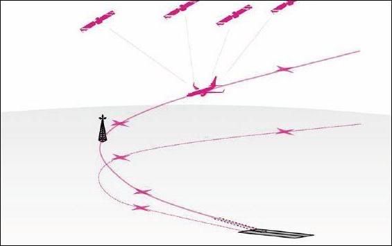
A feature utilized by RNP approach procedures and utilizing the WAAS signal activated one year before September 11, 2001, is the use of descending constant radius turns, known as Radius-to-Fix (RF) turns.[17] Such turns are similar to the 330 degree descending right turn performed by American Airlines flight 77 (AA 77) upon its final approach-to-impact with the Pentagon building on September 11, 2001.[18] The point at which AA 77's 330 degree descending right turn terminated would be comparable to a Final Approach Fix (FAF), from where a straight final runway approach segment would commence.


The Department of Aeronautics and Astronautics at Stanford University described experimental RF turns similar to the 330 degree descending turn performed by American Airlines Flight 77, following 1998 test flights involving a WAAS prototype:
"The Wide Area Augmentation System (WAAS) ... allows pilots to fly ... approaches that cannot necessarily be flown with current instrumentation ... Complex curved approaches, including approaches turning to a short (less than one mile) final ... Pathways were constructed from ... climbing, or descending constant radius arcs ... Autopilots could use WAAS position and velocity to fly curved trajectories."[19]
The attack aircraft flight paths observed on September 11, 2001 would apparently be reproducible by RNP-like segments used in combination, performed by specialized aircraft avionics systems available and certified prior to September 11, 2001 for use within the Boeing 757 and 767 attack aircraft used on September 11, 2001 .
Necessary Systems
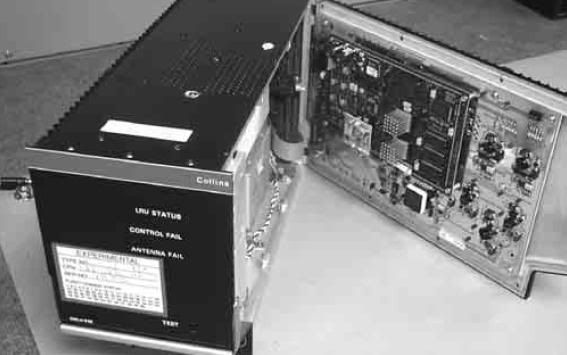
On September 6, 1996 Rockwell-Collins Commercial Avionics announced plans by Boeing and major commercial airlines, to install Rockwell-Collins Multi-Mode Receiver (MMR) landing systems within their Boeing 757 and 767 aircraft.[20] The MMR system can utilize the WAAS signal as well as the basic GPS signal, the VHF, UHF, VOR navigation signals and eventually the LAAS navigation signal.[21]
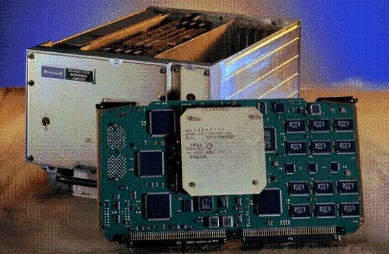
On September 7, 1998 Honeywell International announced plans by American Airlines and United Airlines, to install the RNP-capable Pegasus Flight Management System (FMS) within their Boeing 757 and 767 aircraft, with a 150 waypoint route capacity.[22][23]
Achieved Systems Accuracy
During numerous FAA, U.S. Air Force and National Aeronautics and Space Administration (NASA) sponsored runway approach and touchdown test flights between 1994 and 2002, involving augmented GPS positional signals and the auto-land systems of Boeing 757, 767 and other Boeing 700 series aircraft, horizontal and vertical positional accuracies of just several meters or less were routinely achieved. The four aircraft used to carry out the September 11, 2001 terrorist attacks were also Boeing 757-200 and 767-200 model aircraft. Runways of major U.S. airports like JFK International, Chicago-O'Hare International and Los Angeles International are between 150 and 200 feet wide.[24][25][26] The WTC towers were each 208 feet wide.[27]
During October of 1994 at NASA's Crows Landing Flight Facility in California, 110 autopilot approaches and touchdowns of a United Airlines Boeing 737 aircraft facilitated by augmented GPS positional signals, were successfully conducted, with "accuracies on the order of a few centimeters" being consistently achieved.[28]

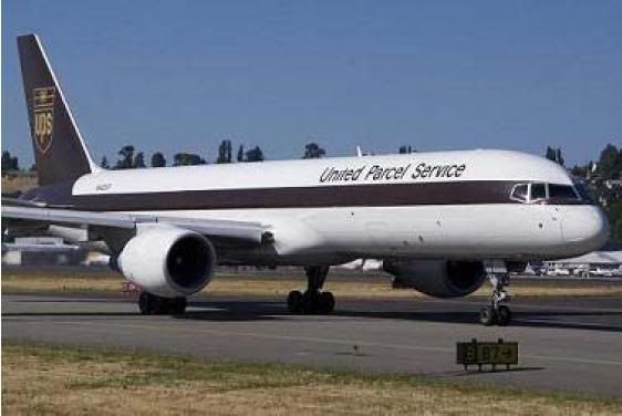
During October of 1994, augmented GPS signal flight tests sponsored by the FAA in cooperation with Ohio University were conducted. 50 autopilot approaches and touchdowns were successfully performed by a donated United Parcel Service Boeing 757-200 series aircraft. The augmented GPS positional signal was integrated into the aircraft Flight Management System (FMS).[29]
During July and August of 1995, Honeywell, Boeing and NASA sponsored tests using NASA's Boeing 757-200 test aircraft and performed 75 autopilot approaches and touchdowns. The predicted augmented GPS system aircraft positional accuracy of 1-2 meters was successfully achieved.[30][31]
During October and December of 1998, WAAS signal enroute navigation and Category I precision instrument aircraft runway approaches were performed over the northern Atlantic ocean and in the nation of Chile, using the FAA's 727 test aircraft. Overall aircraft positional accuracies of 3-4 meters were successfully achieved.[32][33]
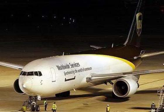
During August of 1999, multiple augmented GPS signal autopilot approach and touchdown tests were performed using a donated United Parcel Service 767 aircraft. These tests were sponsored by the FAA and were centered on the prototype GPS-based Local Area Augmentation System (LAAS), which is intended to compliment the FAA's WAAS service. The LAAS signal can provide aircraft positional accuracy of less than one meter vertically and laterally.[34]
On August 25, 2001, a Fed-Ex 727-200 aircraft equipped with a Rockwell-Collins GNLU-930 Multi-Mode Receiver, conducted six full autopilot approaches and touchdowns during joint U.S. Air Force and Raytheon sponsored test flights, using the Joint Precision Approach and Landings System (JPALS), the military augmented GPS counterpart of the civilian LAAS system.[35]
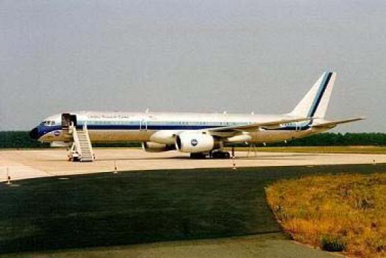
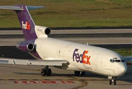 Federal Express 727
On January 17, 2002, a series of autopilot approaches, touchdowns and rollouts, were conducted to further test the LAAS system with a Fed-Ex Boeing 737-900, equipped with a Rockwell-Collins GLU-920 Multi-Mode receiver.[36] The augmented GPS capable GLU-920 Multi-Mode receiver pre-dates September, 2001 and is designed for use within the Boeing 757-200 and 767-200 model aircraft, like those used during the September 11, 2001 terrorist attacks.[37][38]
Comparable Method Patent
On October 9, 2001, Cubic Defense Systems, Inc. applied for a U.S. patent for a system that removes control of an aircraft from its pilot and utilizes an aircraft's auto-pilot system to implement an uninterruptable pre-programmed auto-pilot flight plan in order to navigate an aircraft to a given destination during an emergency. This would be accomplished through the use of electronic or mechanical relays, that become activated by pilot operation of an aircraft hijack notification system. Surprisingly to some, none of the four aircraft destroyed on September 11, 2001 are known to have entered unique transponder hijack notification codes, suggesting either modified function or insufficient activation time. One optional feature of the Cubic system is termination of an aircraft's ability to communicate. In two cases, hijacker communications reportedly aimed at passengers on-board American Airlines flight 11 and United Airlines flight 93 on September 11, 2001 were heard instead by air traffic controllers, suggesting modified communication functions. The Cubic patent also references Honeywell's 1995 augmented GPS flight navigation research and development, apparently as a signal navigation aid. The system also envisions the use of new aircraft flight instructions transmitted by a remote sender, that would override aircraft functions already underway and direct an aircraft auto-pilot system to navigate an aircraft to a predetermined destination.[39] A data link interface between an aircraft Flight Management System (FMS) and the Management Unit for the Aircraft Communication Addressing and Reporting System (ACARS), was developed during the early 1990s. This communication system allows for the update an aircraft FMS in mid-flight.[40] An aircraft auto-pilot system is part of the FMS.
Unreliable Evidence
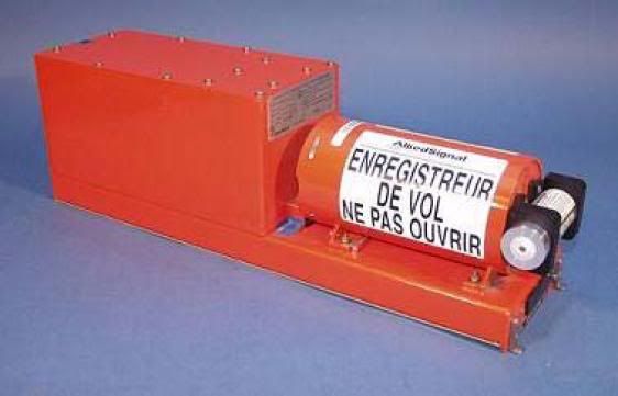
Because the Flight Data Recorders (FDRs) for American Airlines flight 11 and United Airlines flight 175 were not recovered, details regarding the operation of each aircraft are not known. The FDRs for American Airlines flight 77 and United Airlines flight 93 were recovered and indicate pilot control of each aircraft. However, the FDR readout file for American Airlines flight 77 was completed four hours and fifteen minutes before the said FDR was recovered, suggesting false or altered FDR information.[41] And the FDRs for American Airlines flight 77 and United Airlines flight 93 are virtually the only ones during the previous 20 years of major National Transportation Safety Board (NTSB) U.S. aviation mishap investigations, for which unique inventory control serial numbers were not published.[42] Such serial numbers are required to facilitate FDR data readouts.[43] In fact the NTSB possesses no records pertaining to the positive identification of the FDRs for American Airlines flight 77 and United Airlines flight 93.[44]
Hijackers Incapable Avionics Operators
Apparently suspect information obtained from the afore mentioned FDRs for American Airlines flight 77 and United Airlines flight 93 indicates the performance of numerous and complex auto-pilot mode changes by the accused hijack pilots of each attack aircraft.[45] However, unclassified records used by the "9/11 Commission" contain interviews of United Airlines and American Airlines personnel who describe the inability of the said hijackers to perform the flight operations alleged.
"Entering changes to the auto pilot is something that terrorist pilots probably would not have been trained or able to do. Even the United senior pilot, who instructs on how to do that, said that he always has to pause before he makes such corrections to make sure to remembered how to enter the change."[46]
Evidence of Precise Navigation
Increasing the plausibility of precision automated control of the two aircraft striking the WTC, is the fact that each aircraft struck precisely the bottom regions of the only sections within each WTC tower only recently upgraded with thermal protection materials. This would suggest a clandestine relationship between the visually spectacular aircraft attacks upon the WTC and activity pre-September 11, 2001 within each WTC aircraft impact region, intended to initiate structural failure within these regions not generated by the aircraft attacks themselves and to contribute to an appearance of structural failures caused by each aircraft impact.
Floors 92 and above were re-fireproofed between 1995-2000 within WTC 1. WTC 1 was struck at floor 94 by AA 11. Floors 77 and above were re-fireproofed between 1995-2000 within WTC 2. WTC 2 was struck at floor 78 by UA 175.[45][46]
References:
[1] Global Positioning System.
http://www.gps.gov/
[2] The Making of U.S. Foreign Policy -- BIOGRAPHIES OF THE AUTHORS, AMBASSADOR RICHARD LEE ARMITAGE
http://usinfo.state.gov/journals/itps/0900/ijpe/pj52bios.htm
[3] Wide Area Augmentation System.
http://www.faa.gov/about/office_org/headquarters_offices/ato/service_uni...
[4] AMENDED VERSION: Wide Area Augmentation System Signal Now Available, August 24, 2000
http://www.faa.gov/news/press_releases/news_story.cfm?newsId=5249
[5] WAAS Fact Sheet
http://www.freeflightsystems.com/waas_factsheet.htm
[6] DIRECT FLIGHT NEW TECHNOLOGY WILL GUIDE PLANES
http://www.highbeam.com/doc/1P2-8569182.html
[7] WAAS: Back in Step, Avionics Magazine, February 1, 2002
http://www.aviationtoday.com/av/categories/commercial/12571.html
[8] Kent company bringing a navigation revolution
http://seattletimes.nwsource.com/html/businesstechnology/2003316294_naverus22.html
[9] A fuel-saving flight plan
http://money.cnn.com/galleries/2008/fortune/0807/gallery.copeland_naverus.fortune/index.html
[10] DIRECT FLIGHT NEW TECHNOLOGY WILL GUIDE PLANES
http://www.highbeam.com/doc/1P2-8569182.html
[11] Kent company bringing a navigation revolution
http://seattletimes.nwsource.com/html/businesstechnology/2003316294_naverus22.html
[12] Rockwell Collins To Provide Autoland System for Boeing Next-Generation 737, Business Wire, October 5, 1999
http://www.highbeam.com/doc/1G1-55993162.html
[13] Waypoint
http://en.wikipedia.org/wiki/Waypoint
[14] United States Standard For Required Navigation Performance (RNP) Approach Procedures With Special Aircraft And Aircrew Authorization Required (SAAAR)
https://www.faa.gov/about/office_org/headquarters_offices/avs/offices/afs/afs400/afs420/policies_guidance/orders/media/8260.52.pdf
[15] The International GPS Global Positioning System Waypoint Registry TM
http://www.waypoint.org/
[16] FLIGHT MANAGEMENT SYSTEM (FMS) INSTRUMENT PROCEDURES DEVELOPMENT
http://www.faa.gov/about/office_org/headquarters_offices/avs/offices/afs/afs400/afs420/policies_guidance/orders/media/826040B.pdf
[17] FLIGHT MANAGEMENT SYSTEM (FMS) INSTRUMENT PROCEDURES DEVELOPMENT
http://www.faa.gov/about/office_org/headquarters_offices/avs/offices/afs/afs400/afs420/policies_guidance/orders/media/826040B.pdf
[18] Flight Path Study - American Airlines Flight 77
http://www.ntsb.gov/info/Flight_%20Path_%20Study_AA77.pdf
[19] Inflight Demonstrations of Curved Approaches. and Missed Approaches in Mountainous Terrain
http://waas.stanford.edu/~wwu/jennings/publications/ION98/iongps98.pdf
[20] Rockwell's Collins Landing System Picked for Both Airbus and Boeing Planes; Lead Announcement at Farnborough Air Show, PRNewswire, September 6, 1996
http://www.highbeam.com/doc/1G1-18652301.html
[21] GNSS - Frequently Asked Questions - WAAS
http://www.faa.gov/about/office_org/headquarters_offices/ato/service_uni...
[22]Honeywell Announces Orders For New-Generation "Pegasus" Flight Management System, Aviation Week, September 7, 1998
http://www.aviationnow.com/shownews/farnday1/pressr15.htm
[23] Boeing 757/767 State of the Art Upgrade
http://www.honeywell.com/sites/aero/Flight_Management_Systems3_C1997B88E...
[24] JFK International Airport
http://upload.wikimedia.org/wikipedia/commons/b/b0/JFK_airport_map.gif
[25] Chicago-O'Hare International Airport
http://upload.wikimedia.org/wikipedia/commons/3/30/ORD_airport_map.PNG
[26] Los Angeles International Airport
http://upload.wikimedia.org/wikipedia/en/a/a3/LaxAirportDiagram2.jpg
[27] The World Trade Center
http://en.wikipedia.org/wiki/Image:World_Trade_Center_Building_Design_wi...
[28] GETTING TO THE POINT IN PINPOINT LANDING, NASA, 1998
http://www.sti.nasa.gov/tto/spinoff1998/t2.htm
[29] FAA/Ohio University Avionics Engineering Center Partnership, Federal Aviation Administration, December, 1998
http://www.tc.faa.gov/logistics/grants/success/OU.pdf
[30] Honeywell's Differential GPS Satellite Landing System, reprinted from Avionics News Magazine, September, 1996
http://www.bluecoat.org/reports/Lewison_96_DGPS.pdf
[31] ARIES: NASA's 'Flying Lab' Takes Wing
http://oea.larc.nasa.gov/PAIS/757.html
[32] FAA Performs Successful Satellite-Based Flight Tests Over the North Atlantic
http://www.faa.gov/news/press_releases/news_story.cfm?newsId=4868
[33] FAA Completes Successful WAAS Flight Trials in the Republic of Chile
http://www.faa.gov/news/press_releases/news_story.cfm?newsId=4898
[34] FAA, ATA, UPS Test New Satellite Technology, Federal Aviation Administration, August 13, 1999
http://www.faa.gov/news/press_releases/news_story.cfm?newsId=5052
[35] Civil-Military Interoperability For GPS Assisted Aircraft Landings Demonstrated
http://www.spacedaily.com/news/gps-01k.html
[36] Raytheon conducts successful flight test of global positioning system (GPS) precision landing system
http://www.raytheon.com/newsroom/briefs/022102.html
[37] FedEx Express Selects Rockwell Collins Multi-Mode Receivers
http://www.rockwellcollins.com/news/page2930.html
[38] GLU-920 MMR Global Landing System
http://www.rockwellcollins.com/ecat/AT/GLU-920.html?smenu=204
[39] Anti-hijacking system operable in emergencies to deactivate on-board flight controls and remotely pilot aircraft utilizing autopilot, United States Patent, Filed: October 9, 2001
http://patft.uspto.gov/netacgi/nph-Parser?Sect2=PTO1&Sect2=HITOFF&p=1&u=%2Fnetahtml%2FPTO%2Fsearch-bool.html&r=1&f=G&l=50&d=PALL&RefSrch=yes&Query=PN%2F6641087
[40] Aircraft Communication Addressing and Reporting System
http://en.wikipedia.org/wiki/ACARS
[41] NTSB Affirms Dubious Explanation For Pentagon "Black Box" Data File Time Stamp Discrepancy
http://www.911blogger.com/node/18294
[42] Was Essential 9/11 Aircraft 'Blackbox' Identification Information Withheld From NTSB?
http://www.911blogger.com/node/16089
[43] Flight Data Recorder Handbook for Aviation Accident Investigations
http://www.ntsb.gov/Aviation/Manuals/FDR_Handbook.pdf
[44] NTSB Elaborates On Absent Records Pertaining To Positively Identified 9/11 Aircraft Wreckage, Including 2 Flight Data Recorders
http://www.911blogger.com/node/17139
[44] NTSB Elaborates On Absent Records Pertaining To Positively Identified 9/11 Aircraft Wreckage, Including 2 Flight Data Recorders
http://www.911blogger.com/node/17139
[45] Study of Autopilot, Navigation Equipment, and Fuel Consumption Activity Based on United Airlines Flight 93 and American Airlines Flight 77 Digital Flight Data Recorder Information
http://www.ntsb.gov/info/autopilot_AA77_UA93_study.pdf
[46] COMMISSION SENSITIVE UNCLASSIFIED - MEMORANDUM FOR THE RECORD - Interviews of United Airlines and American Airlines personnel in key roles on September 11, 2001
http://media.nara.gov/9-11/MFR/t-0148-911MFR-01098.pdf
[47] Another amazing coincidence related to the WTC
http://www.911blogger.com/node/13272
[48] Federal Building and Fire Safety Investigation of the World Trade Center Disaster: Passive Fire Protection
http://wtc.nist.gov/NISTNCSTAR1-6A.pdf
[49] World Trade Center Building Performance Study
http://www.fema.gov/pdf/library/fema403_ch1.pdf
FAIR USE NOTICE: This site contains copyrighted material the use of which has not always been specifically authorized by the copyright owner. We are making such material available in our efforts to advance understanding of criminal justice, political, human rights, economic, democracy, scientific, and social justice issues, etc. We believe this constitutes a 'fair use' of any such copyrighted material as provided for in section 107 of the US Copyright Law. In accordance with Title 17 U.S.C. Section 107, the material on this site is distributed without profit to those who have expressed a prior interest in receiving the included information for research and educational purposes. For more information go to: http://www.law.cornell.edu/uscode/17/107.shtml. If you wish to use copyrighted material from this site for purposes of your own that go beyond 'fair use', you must obtain permission from the copyright owner.
Source


