Because information collected after the terrorist attacks of September 11, 2001 has raised questions about the alleged ability and motivation of the people accused of piloting Boeing 757 and 767 planes into the World Trade Center, the Pentagon and a field in Shanksville, Pennsylvania, speculation has since lingered regarding the covert use of technology to precisely self-navigate all 4 airliners into targets that day.
Government and aviation industry publications shed light on the development and implementation of pre-9/11 state-of-the-art systems capable of facilitating precise automated navigation of the Boeing 757 and 767 aircraft used during the 9/11 attacks, to a given destination.
"WAAS (Wide Area Augmentation System) is an extremely accurate navigation system developed for civil aviation. Before WAAS, the U.S. National Airspace System (NAS) did not have the potential to provide horizontal and vertical navigation for approach operations for all users at all locations. With WAAS, this capability is a reality ... WAAS provides service for all classes of aircraft in all phases of flight - including en route navigation"
Just 13 months before the September 11 terrorist attacks, the WAAS GPS satellite array was activated by the FAA and operated by "Raytheon" on a preliminary basis.
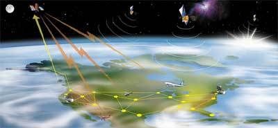
August 24, 2000
"WASHINGTON, DC — After a successful 21-day stability test of the Wide Area Augmentation System (WAAS) signal in space, the U.S. Department of Transportation's Federal Aviation Administration (FAA) declared that it is now available for some aviation and all non-aviation uses ... The system demonstrated one to two meters horizontal accuracy and two to three meters vertical accuracy throughout the contiguous United States ... Raytheon will operate the system for the FAA on a continuous basis"
One member having served on Raytheon's Special Advisory Board is "Project for the New American Century" signatory Richard Armitage.

Only 3 weeks after the September 11, 2001 terrorist attacks, a patent was applied for regarding a system that would override pilot control from an autopilot equipped aircraft and redirect such an aircraft to a predetermined destination via pre-programmed autopilot settings. This patent cites the Differential Global Position Satellite research and development conducted by Honeywell and NASA during the mid-1990s.
""A method for ... deactivating on-board control of the autopilot system; directing the autopilot system to fly the aircraft to a landing."
"One optional feature of the invention disables the aircraft's communications equipment."
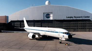
July/August, 1995
"The Honeywell team participated in Boeing’s Category III-b flight test evaluation program in July and August of 1995. NASA supplied the 757 aircraft and flight test facility. Boeing supplied the pilots, ground crew, maintenance, flight test personnel and performed the aircraft modifications for the flight tests. The flight tests were accomplished at NASA’s Wallops Island, Virginia, flight test facility. A total of 75 Category III-b automatic landings were accomplished during this phase of flight testing. The autopilot used the DGPS to guide the aircraft to a landing and ... performance data of these flight tests showed that the Honeywell DGPS landing system achieved the predicted system accuracy of one to two meters."
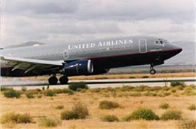
October, 1994
"A high-performance navigation system used primarily for automatic aircraft touchdowns promises centimeter-level landing accuracy.During a four-day period in October 1994, the idea was put to the test on Runway 35 at NASA's Crows Landing Flight Facility in California. Using signals from orbiting GPS satellites and the ground-generated pseudolite signals, 110 autopilot-in-the-loop landings of a United Airlines Boeing 737 were completed."
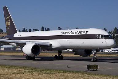
December, 1998
"Ohio University's Avionics Engineering Center recently developed and successfully flight-tested technology that increases the availability and accuracy of the Global Positioning System (GPS) ... This technological breakthrough is the result of a 5-year aviation research grant provided by the FAA to the Avionics Center to design, implement, and test an advanced prototype GPS-based approach, landing, and surface movement guidance system ... Pilots from United Parcel Service (UPS) flight tested the new architecture in October 1994, using a UPS Boeing 757, completing a total of 50 automated landings. During those tests, researchers integrated Differential Global Positioning System into the Boeing 757 autoland system."
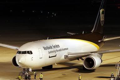
August 13, 1999
"In the Atlantic City tests, a "UPS Boeing 767 flown by company pilots will perform 40 approaches down to as low as 25 feet above the runway. The pilots will fly some approaches manually; others will be coupled to the aircraft's autopilot. The LAAS and GPS signals will be processed by equipment specially installed aboard the 767 for these tests. LAAS can tell pilots where their aircraft is to an accuracy of less than one meter, and the system can be used in all visibility conditions. It complements the Wide Area Augmentation System (WAAS) that the FAA is now developing and acquiring."
On September 7, 1998, it was announced that American Airlines and United Airlines selected Honeywell's new GPS capable "Pegasus" Flight Management System (FMS) for use in their Boeing 757 and 767 aircraft.
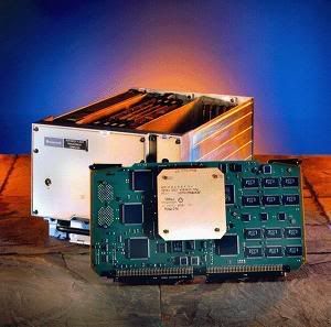
"A flight management system or FMS is a computerized avionics component found on most commercial and business aircraft to assist pilots in navigation, flight planning, and aircraft control functions. It is considered to be composed of three major components: FMC (Flight Management Computer), AFS (Auto Flight System), and Navigation System including IRS (Inertial Reference System) and GPS."

April 18, 2004
"In the two years before the Sept. 11 attacks, the North American Aerospace Defense Command conducted exercises simulating ... hijacked airliners used as weapons ... NORAD, in a written statement, confirmed ... "Numerous types of civilian and military aircraft were used as mock hijacked aircraft "".

